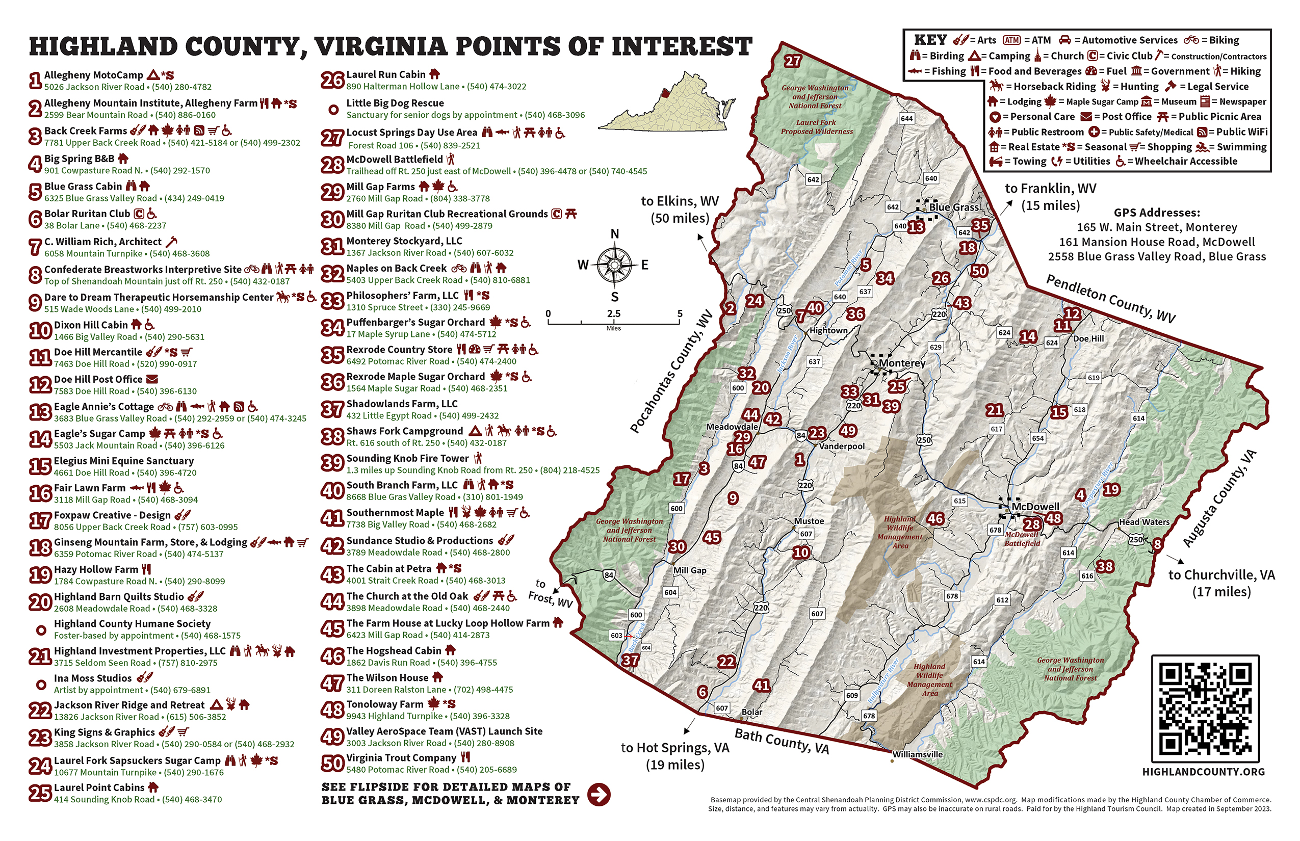
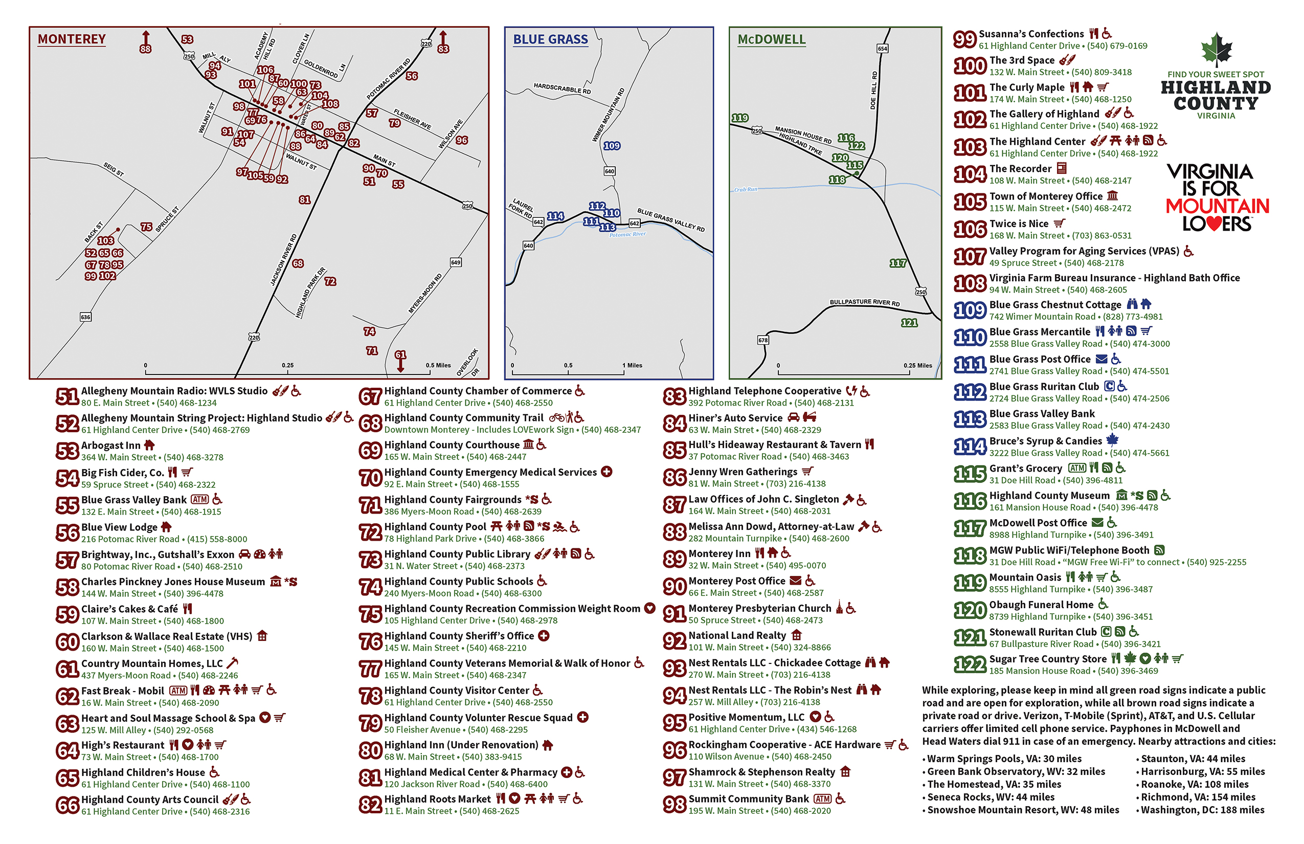
Highland County Tourism Map • Pick up a copy at local businesses or order one by clicking here!
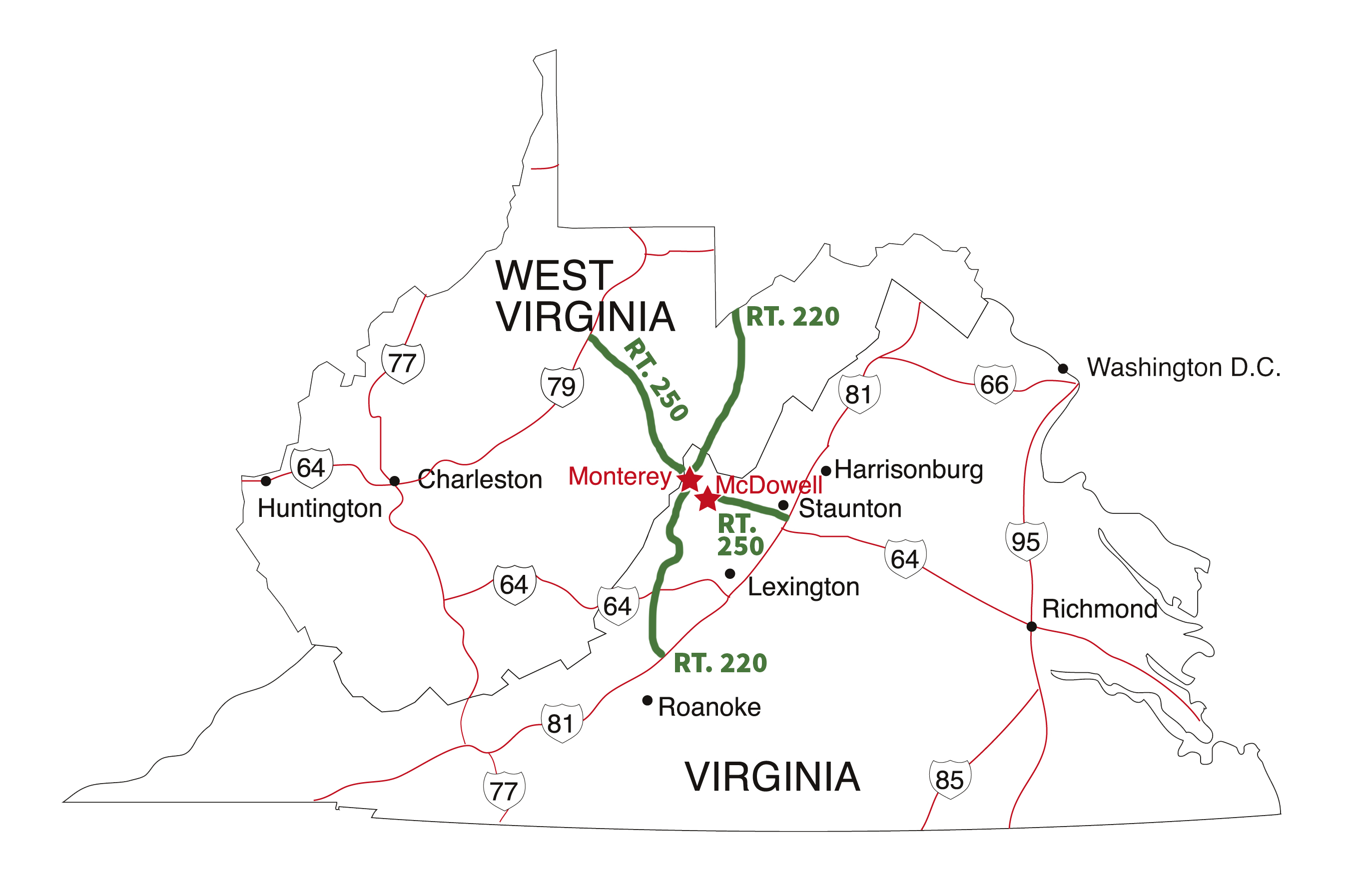
Highland County is nestled in the Allegheny Mountains on the western upland side of the famed Shenandoah Valley. Interstate Highways 81 and 64 connect to US Routes 250 and 220 — both of which lead directly to the county seat of Monterey.
FROM THE NORTH: Travel south on I-81 to exits #225 (bypasses Staunton) or #222 (Staunton exit). Travel west on US 250 to McDowell (35 miles) and/or Monterey (45 miles). US 250 is an excellent road, however, it does wind across several mountains. Allow approximately 50 minutes driving time to McDowell and a little over 1 hour from the junction with I-81.
FROM THE EAST: Follow I-64 west to I-81. Travel north on I-81 to the first exit (#222 at Staunton) and follow the above directions west on US 250. Allow approximately 50 minutes driving time to McDowell and a little over 1 hour from the junction with I-81.
FROM THE SOUTH: Travel north on I-81 to exit #222 (Staunton exit) and follow the above directions or take exit #150 (north of Roanoke) and follow US 220 north into Monterey (125 miles). Allow approximately 1 hour and 45 minutes driving time from exit #150.
FROM THE WEST: Travel east on US 250 or east on I-64 to exit #181 and north on WV 42 to Frost to WV 84 to Monterey. Allow approximately 1 hour driving time from Elkins or 2 hours from White Sulphur Springs


